︎
Public Green Spaces in Metro Manila
︎︎︎ Map, poster
︎︎︎ Multimedia Mapping, Wintersession 2022, RISD
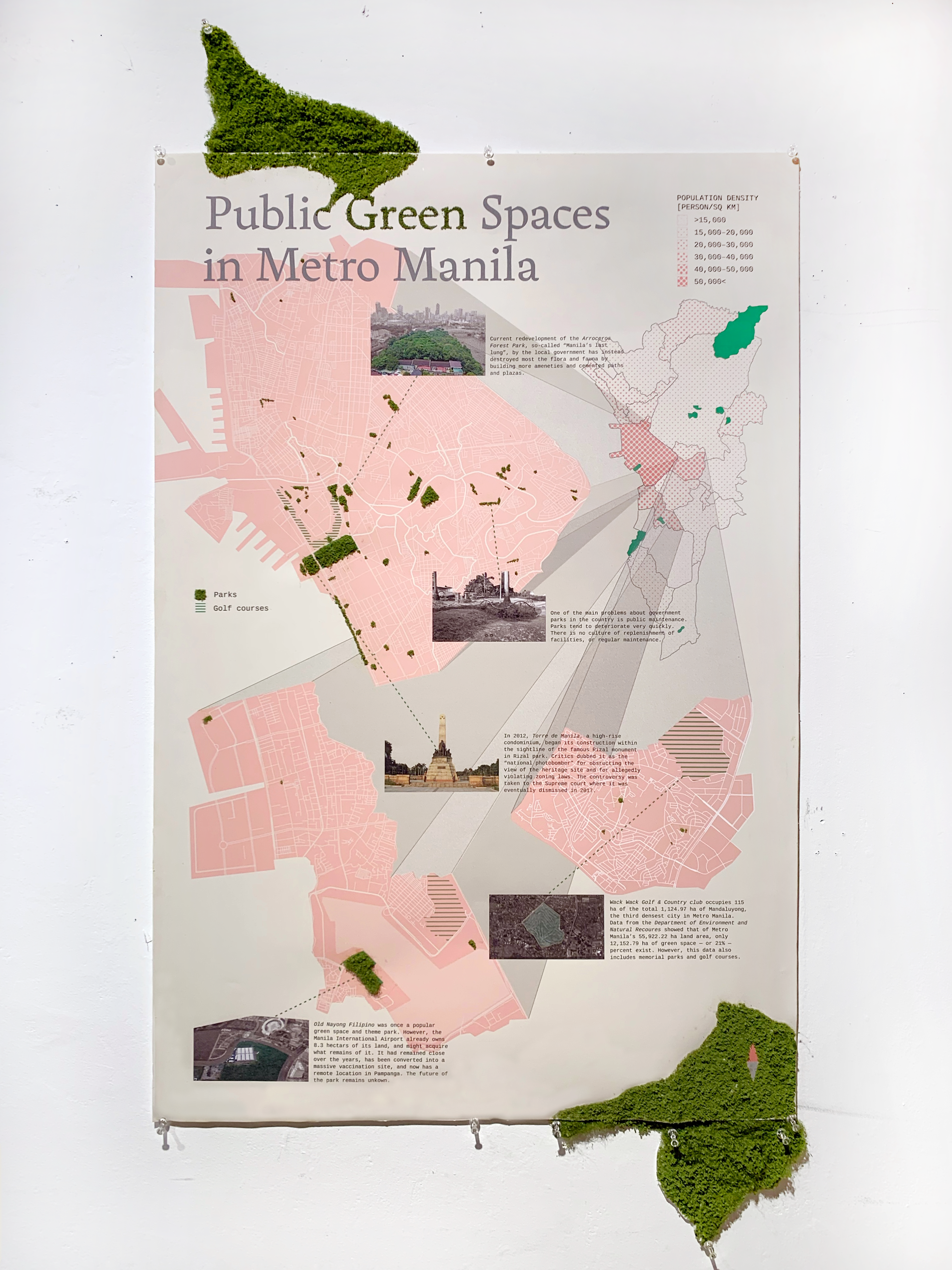
This map shows the population density of Metro Manila—the Philippines’ seat of government—and zooms in on the top 3
densest cities to show how little publicly accessible green spaces are available to
the population. To further stress this scarcity, golf courses are mapped out to show how much of it is also wasted. Moreover, a few callouts highlight certain stories and contextual information about some of the remaining green spaces in each city.